| IMPORTANT: The content of this page is outdated. If you have checked or updated this page and found the content to be suitable, please remove this notice. |
|---|
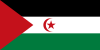
That patch of land, usually known as the Western Sahara, is the biggest patch of land currently non-self-governed in the world. It’s also known as the Sahrawi Arab Democratic Republic by the self-proclaimed government (exiled in Algeria). The largest city (and the one we would normally call “capital”, if it weren’t for the fact that it has no established government) is El Aaiún (also called Laayoune).
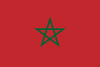
Originally a Spanish colony, it handed the administration of the colony in 1975 to a joint effort by Morocco and Mauritania (Morocco had started claiming it since 1957). They couldn’t get along and eventually a war erupted; that’s when the Polisario Front, a Sahrawi national liberation movement, proclaimed the independence of the Sahrawi Arab Democratic Republic. When the war ended, Morocco took possession of the terrain, reclaiming it as such.
The place itself is almost a Death World with mostly desert, interrupted by the occasional highway that goes from town to town, its shores are too high and rocky to be used as beaches or ports and it doesn’t seem to have much oil (or at least, it’s not that accessible). The population is barely over 500,000 people, between Moroccans and Sahrawis, nomadic tribes of mixed Arab-Berber heritage.
The place as of today is divided between a zone controlled by Morocco (next to the shore) and a zone controlled by the Polisario Front (the inland part). The Moroccan part is by far the more heavily populated, and the Moroccan government has been working like hell to develop the region and endear it to the government in Rabat. The Front is backed by Algeria, which is seen as the one who pulls the strings of the Front. The Algerians see the conflict as part of a wider grudge against Morocco that started when the Moroccans attempted to take some territory on their border (which had been transferred from Morocco to Algeria by the French... don't ask why both countries don't forget about that whole business and gang up on the French). Morocco, on the other hand, is supported by France and, occasionally, by America. None of them is willing to back down, though Morocco is willing to offer the status of autonomous community within the kingdom. This comes as no surprise since Spain, Morocco's former master, counts various autonomous communities as part of its dominion to this day.

